|
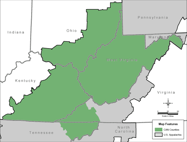
CAN (Central Appalachian Network) Region
Maps
�
�
(Note: This is part of the nationwide map of The Wildlands Project,
although it is carefully couched in extreme Language Deception.)
�

�
�
Download Additional Maps (Adobe Acrobat Reader required): � http://www.cannetwork.org/about/maps/can.pdf
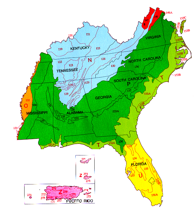
http://www.cannetwork.org/about/maps/can_noanno.pdf http://www.cannetwork.org/about/maps/cannostate.pdf � http://www.cannetwork.org/about/map.php � Additional researched, recommended reading: � Major Land Resource Areas in MO-15: � � The capital letters on the map indicate Land Resource Regions. The numbers on the map indicate Major Land Resource Areas. A Major Land Resource Area is a geographic area, usually several thousand acres in extent, that is characterized by a particular pattern of soils, climate, water resources, land uses, and type of farming. A complete description of of each Land Resource Region and each MLRA is available at http://soils.usda.gov/survey/geography/mlra/.
|
